Morning mountains above Ganges
Salt Spring Photographer John Cameron

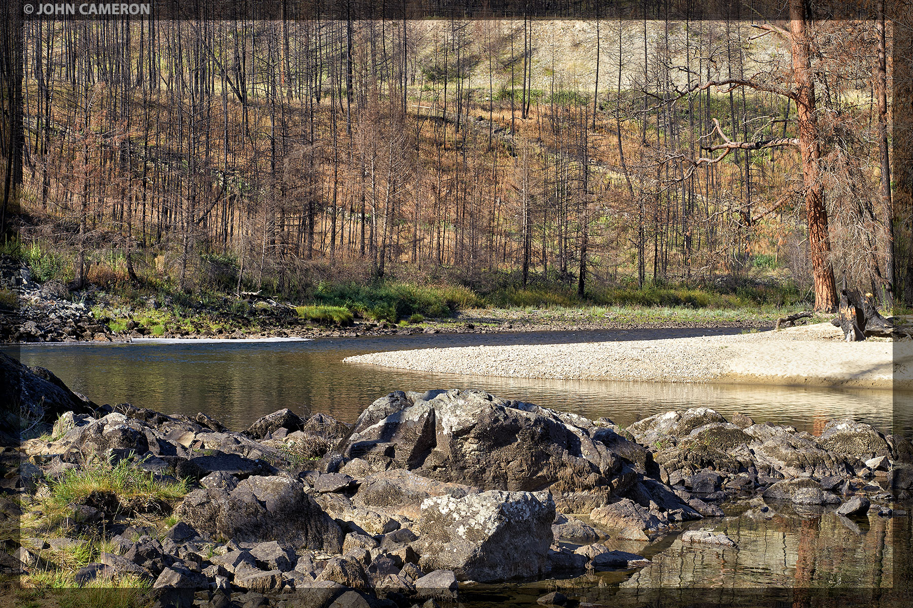
Last August we saw news and videos of a raging wildfire near Rock Creek and the nearby Kettle River Provincial Park. Twelve months later, near the end of our Kootenay trip, we stopped for a couple of wonderful days at the Park and saw first hand the burned Ponderosa Pines. (The lower campsite was open and seemingly untouched).
As we walked though the area above the campsite, it was fascinating—to me at least, how fast the forest floor plants had rebounded in just one growing season. On this walk, we watched a man catch and release a lovely Rainbow Trout. We saw pheasant, quail and many smaller birds. This was strange given the black and somewhat eerie scene.
Strange too as the two blackened pines in the foreground of the photo are along the river’s edge. Yet when we turned ninety degrees toward the river we saw this tranquil scene:

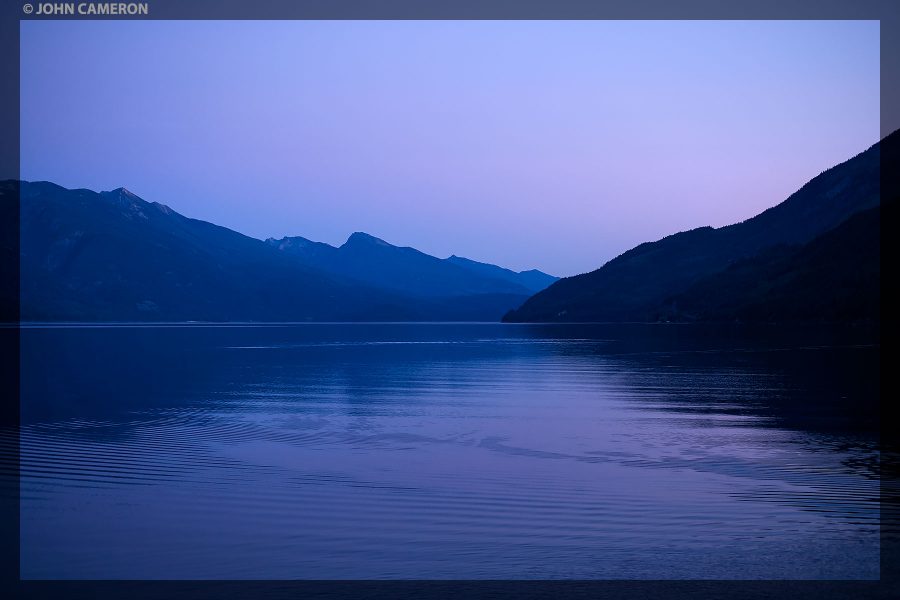
Stunning sky to wake up to.

Sunrise from the campsite at Davis Creek Campground on Kootenay Lake
Bonus Images:

Large, lakefront campsite on NW shore of the lake

Shoreline walk beyond Davis Creek Campground

Moonrise from the Campsite
Evening view from ‘bedroom’ window

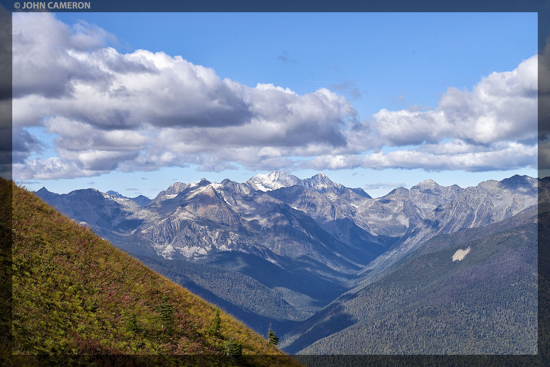
South West View from Idaho Peak
After a challenging (steep, very narrow, twisty, rough) 12.5 kilometer drive from Sandon there are two breathtaking trails to the top of Idaho Peak. The photo above is approximately one-quarter of the 360º view at the top (from the former forestry lookout). Each part of the 360º view is equally stunning.
If you look closely you can see a trail on the lower right side of the image. This is the final part of the trail along the ridge to the summit. Look even closer (at the bright green patch in the center of the image) and you might see the trail cut across and disappear into the trees.
Bonus:
Here’s the trail we took to the top (the foreground of this image is that green patch at the centre of the top photo). And yes the ground was frozen on September 24th; there’s some snow around and the path is very narrow in spots. One slip and you’d be down with the black bears and the grizzly that were seen below—one half hour earlier.
The lookout at the peak is that little box on the top right of the image. We saw two hang gliders around this time during our hike. And ten minutes later, met a man heading back down to his truck; his buddies—the hang gliders—needed no further assistance as they would be landing back home in New Denver. (from the peak, you can see all of New Denver and Silverton)