Salt Spring Photos

Salt Spring Photographer John Cameron

You are here: Home / Search for "erskine"

Search Results for: erskine

Mount Erskine Hike

September 8, 2016

Mt. Erskine Hike
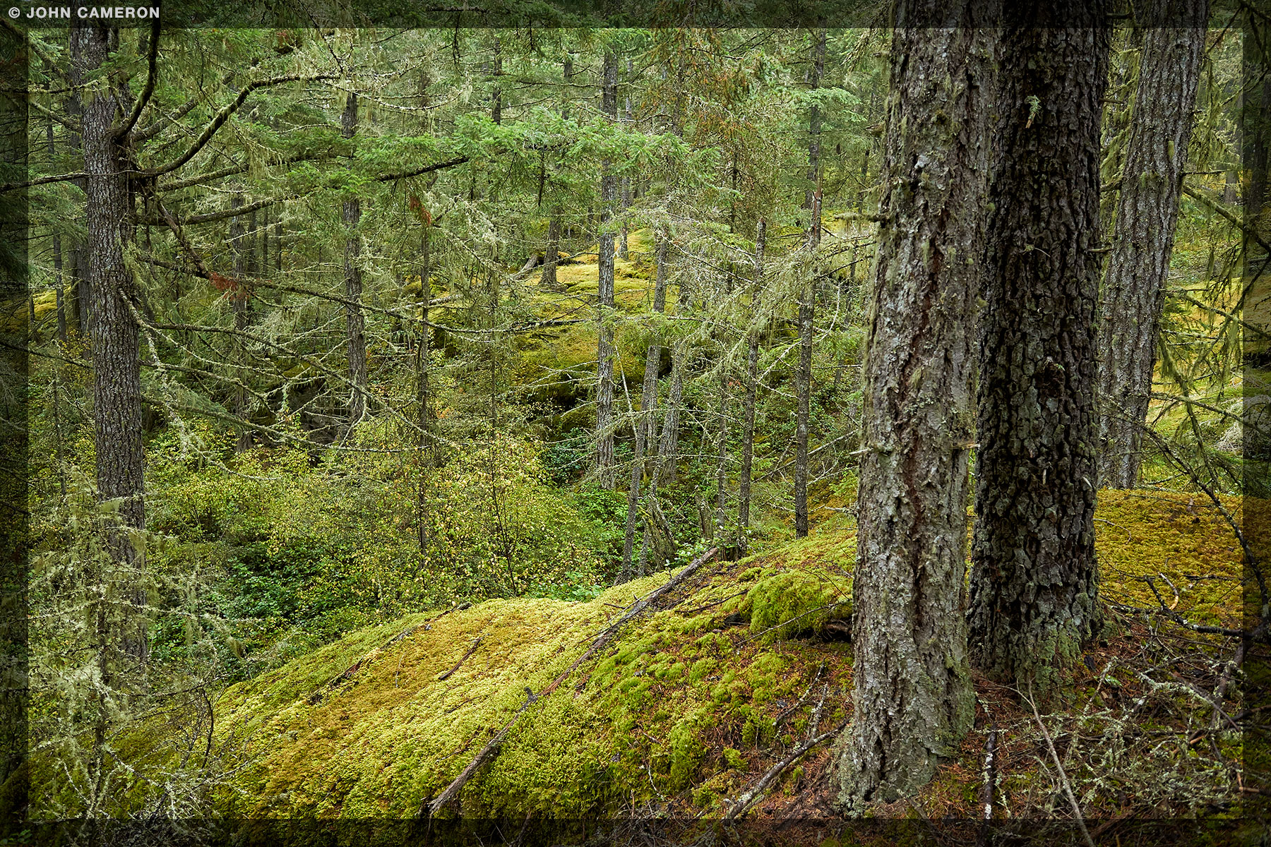
It’s been awhile since Cameron and I have hiked to the Erskine summit. We headed up yesterday in the rain and saw something we hadn’t seen for months: puddles!

Despite the drought, the forest greens were looking healthy. There were also signs of heavy trail use, but not a single bit of litter.

Filed Under: Ganges, Mountain, Nature, View Tagged With: forest, green, hike, rain

Winter View from Mount Erskine

January 10, 2016

Mt. Erskine in snow and fog

10:00 am, south of the Mount Erskine summit

Another day, another hike. This time on the Erskine Trails, with the marginally faithful Westie: Cameron.
The fog, frost and snow make it so quiet, peaceful and different from the usual view.
Caution required though as one step off that ledge takes you very quickly to forest floor many hundreds of feet below.

There are only so many mountains on a small island like Salt Spring. So it’s been mentioned and photographed before on this website. Quickly browse the other Erskine posts by typing erskine in the search box at the bottom of the website. Or, if you’re in a big hurry, just click here.

Filed Under: Mountain, Nature, Photog's Favourites, Vesuvius, View Tagged With: colour, fog, hike, Mt. Erskine, sky, snow, vancouver island, winter

From Erskine Summit South

October 15, 2015

From Erskine Summit South

Did you know there’s a trail from the Mount Erskine summit that winds its way south along the ridge?

Filed Under: Mountain, Nature, View Tagged With: autumn, colour, forest, green, hike, Mount Erskine, trees

Wildfire Smoke seen from Mount Erskine Summit

July 6, 2015

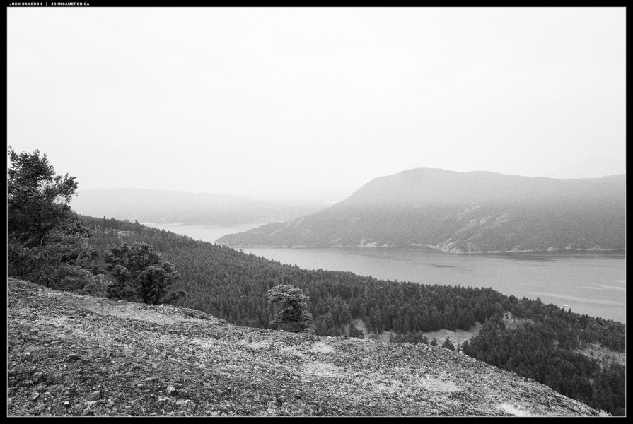
Wildfire Smoke Obscures Mt. Erskine View

North towards Nanaimo

A tinder dry hike to the Mount Erskine summit reveals the extensive wildfire smoke in the air.

Wildfire Smoke Obscures Mt. Erskine Views

South West toward Cowichan Bay on Vancouver Island


* bonus update
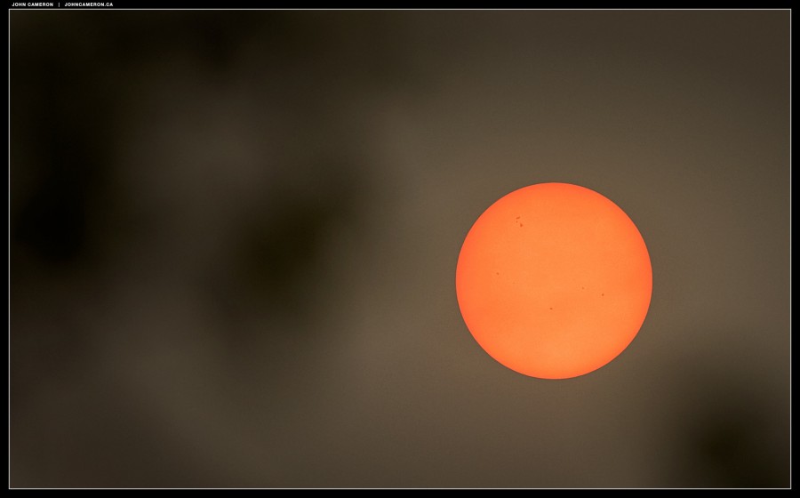
Here’s a view of the sun from the ‘clothesline observation platform’ at our house. This is the Sun through some Arbutus branches. I’ve not seen the sky and sun like this. Very smoky up the mountain where we live. Lots of haze down at ocean level, but no smoke smell there tonight.

Sun and sky during wildfire season

Filed Under: Mountain, Nature, View Tagged With: forest, ocean, sky, summer, trees, wildfire smoke

Hiking Mount Erskine Salt Spring Island

April 15, 2014

Mount Erskine Summit by John Cameron

A fairly easy hike up the back side of Mount Erskine reveals a panoramic view of Sansum Narrows, Vancouver Island, Mount Arrowsmith, Chemainus and Nanaimo, and east across Trincomali Channel to Galiano Island and the Lower Mainland.

There are three main trails to the summit of the mountain. The first two are the most well known. Salt Spring’s version of the Grouse Grind starts at Collin’s Road. Alternately there’s a somewhat less interesting route from Toynbee Road (near Mount Maxwell). The third way starts at a higher elevation and is the ‘easy’ way to the top.

Access this route via Juniper Place. Turn right on Trustee Trail and continue to the large cul de sac. There’s lots of room to park here. The hike to the top of Mount Erskine takes about 35  to 40 minutes when done at a leisurely pace. There’s a trailhead post at the side of the road. A short way down the trail you leave private land and enter Mount Erskine Provincial Park. This is Dodds Trail.

Trail Entrance

About 8 minutes along Dodds Trail you’ll come to an unmarked intersection. Turn left and uphill here. You’re on Lassies Trail. (GPS +48° 51′ 11.12″, -123° 32′ 50.84″)

Turn Left up the Mountain

A pretty walk with some long gentle switchbacks.

Keep right for the summit

About half an hour from the bottom you will come to another unmarked intersection. Both forks are the Mount Erskine Trail. The left fork goes to Toynbee Road (a very long way from your car). Take the right fork (north) about 5 minutes to the summit. (GPS +48° 50′ 49.81″, -123° 32′ 45.22″)

Erskine Summmit

Mt. Erskine Summit looking North

You don’t really want to go back down the same trail, do you? OK. So, from the summit, continue north down the aggregate rock. Keep an eye out for a fork in the trail; take the right fork into the Douglas Fir forest. In a minute or two you’ll see this fairy door on the right side of the trail:

Fairy Door at Mt. Erskine

You’ve noticed this trail is much steeper. About 15 minutes from the top you’ve decended as far as you need to, and be sure to look for a ‘T” junction. Take the lesser travelled path to the right. (Cameron, the Westie, is pointing the way. OK, not literally. And don’t expect to see him there…). If you go left you’ll end up at Collins Road, again a long way from your car.

Turn right back to your car

In a minute you’ll pass the Lassies Trail on the right, you took this trail up to the summit. Unless you want to go up again, continue straight, about 8 minutes to your car.

Filed Under: Mountain, Nature, View

  • 1
  • 2
  • 3
  • …
  • 5
  • Next Page »

Photos by John Cameron

Photographs of Salt Spring Island and areas reachable by ferry and road (and sometimes off-road).

SEARCH THIS WEBSITE:

Browse the Photo Blog:

The latest seven posts all on one page

Recent Salt Spring Photos:

  • The Perfect Salt Spring Day
  • Upside Down
  • Late November on St. Mary Lake
  • No Touchy Touchy
  • Salt Spring Walk
  • Bed
  • Brrrrr…

View Everything:

Find photos by month or category

Copyright © 2026   John Cameron | All Rights Reserved