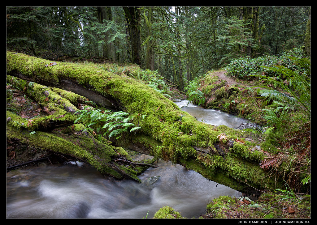
The trail crosses a small bridge over this stream. This is the intersection; left is a short downhill walk to the south side of Cusheon Cove. Or straight ahead to a slightly longer walk down to Yeo Point, on the edge of Ruckle Provincial Park.
Salt Spring Photographer John Cameron
The trail crosses a small bridge over this stream. This is the intersection; left is a short downhill walk to the south side of Cusheon Cove. Or straight ahead to a slightly longer walk down to Yeo Point, on the edge of Ruckle Provincial Park.

Recent foggy days have turned the ‘moss switch’ on. The trees and rocks seem to glow.
I took advantage of the dreary weather to explore a south Salt Spring Island trail. It turns out to be a gem—a fun walk through a cedar forest full of surprising things to look at while listening to the sounds of rushing streams and distant ocean activity. It would be a disservice to document all the creations—and spoil the surprise.
You can find out yourself if you’re on the Island. To get to the start of the trail: south on Beaver Point Road, left on Bullman, then right down Meyer to the end. Lots of parking at the turn around. It’s an easy, slightly downhill trail about one kilometre in length.
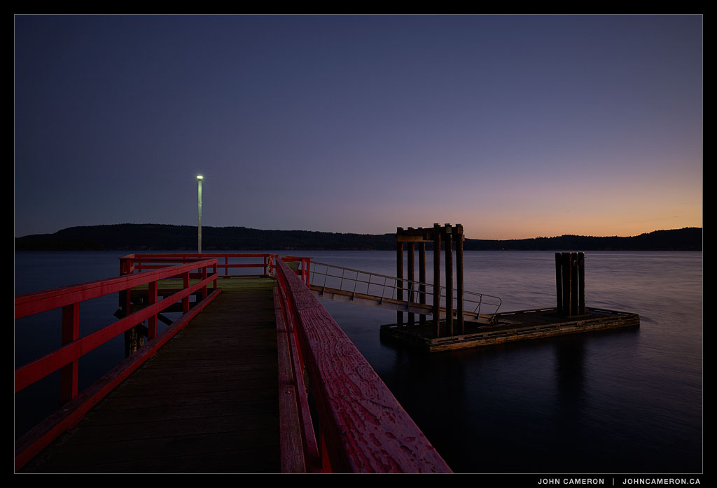
I think this is often the best time of day.
The dark about 45 minutes before the sun rises.
Peaceful, solitary, stunning.

A beautifully dark and damp day in the fog and low cloud of a temperate rainforest.
After more than 30 years living in the same area, I stumbled across this neighbourhood trail.

In the flat blue light of a cold, overcast day I came across a scene of Alder trees along the edge of a frozen pond. There was incredible detail to be captured in all the branches. After a few edits, I settled on black and white to ‘focus’ attention on the details. And cropped the image to show just the trees. This looks fantastic on a thirty inch screen.
Here’s the full image:
